Spain's Other Country
The Canary Islands are technically Spain. Technically. They use euros, they speak Spanish, the supermarkets sell Mercadona brand olive oil. But these seven volcanic islands sit 100 kilometers off the coast of Africa, over 1,000 kilometers from Madrid, and they feel like an entirely different country that happens to share a flag. The landscapes here are so varied and so extreme that calling them "Spanish islands" sells them so short it's almost insulting.
We're talking about a place where you can stand on top of Spain's highest mountain (a literal active volcano), drive through a lava field that looks like Mars, hike into a prehistoric forest that hasn't changed since the dinosaurs, watch clouds pour over a mountain ridge like a waterfall, swim in a turquoise pool inside a lava tube, and then sit down for wrinkly potatoes with spicy sauce. All of this within an archipelago small enough that you can fly between islands in 30 minutes.

Each island is its own world. Tenerife has Spain's highest peak and the kind of resort infrastructure that handles millions of visitors a year. Lanzarote is a volcanic moonscape turned into an art project by one brilliant man. Gran Canaria is called the "mini continent" because it somehow contains sand dunes, pine forests, and dramatic canyons on one small island. La Palma had a volcanic eruption in 2021 and has the densest laurel forest in the Canaries. Fuerteventura is a beach paradise blasted by wind. La Gomera has a language made entirely of whistles. El Hierro is so small and remote that most Spaniards have never been there.
The trade winds hit the north sides of the islands, creating a bizarre climate split where one half of each island is lush and green and the other half is arid desert. The weather is warm year-round, never really cold, never brutally hot, and the sun situation from November to March is the reason half of northern Europe keeps a low-cost airline bookmark ready.
Tenerife
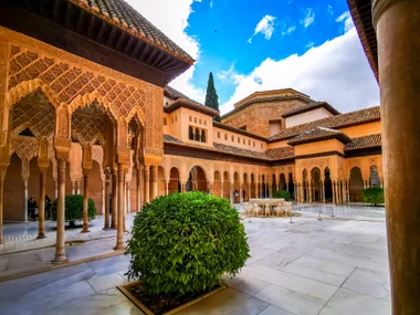
Tenerife is the biggest, most visited, and most contradictory of the Canary Islands. The south coast is a wall of resort hotels, package-holiday complexes, and British pubs showing Premier League football. The north coast is green, misty, and scattered with old Canarian towns. And in the middle, towering above everything, is Mount Teide: a 3,718-meter stratovolcano that's the highest point in all of Spain and the third-tallest volcanic structure on earth (measured from the ocean floor). The island basically is the volcano. Everything else is just what grew around it.

Teide National Park is a UNESCO World Heritage site and the most visited national park in Europe, which tells you something about the magnetic pull of this landscape. The caldera at the top is a vast, otherworldly plateau of lava flows, volcanic rock formations in every shade of red and orange, and a silence that's almost eerie. The road through the park, especially at sunset, is one of those drives that makes you forget how to form sentences. You just stare.

You can take a cable car up to near the summit (3,555 meters), but reaching the actual peak requires a free permit that you gotta book months in advance. Even without the summit, the cable car station offers views that stretch across multiple islands on clear days. At night, the park is one of the best places on earth for stargazing. The lack of light pollution and the high altitude make the stars feel close enough to touch, and guided astronomy tours run regularly.
The north of Tenerife is where the island shows its greener face. The Anaga Rural Park is a mountain range covered in ancient laurel forest, with misty trails, dramatic viewpoints, and tiny villages that feel completely removed from the resort world down south. The contrast between Anaga's dripping green jungle and the volcanic desert around Teide is one of the most striking things about the island.
The weather split between north and south is no joke. When I was on Tenerife, it rained the entire week in the north, where my hotel was, while the south coast was cloudless and sunny. Every single day. The trade winds push moisture against the northern mountains, where it condenses into clouds and rain, while the south side sits in a rain shadow and bakes in the sun. If you're booking accommodation, this matters: the south is virtually guaranteed sunshine, the north is lush and beautiful but comes with a real chance of grey skies and drizzle, especially in winter.

The towns on the north coast (La Orotava, Puerto de la Cruz, Garachico) have genuine Canarian character: colonial architecture, banana plantations climbing the hillsides, and plazas where old men play dominoes while the Atlantic pounds the rocks below. Santa Cruz de Tenerife, the capital, hosts one of the world's biggest carnivals every February, second only to Rio de Janeiro if you believe the locals (and I kinda do, having seen the footage).
Lanzarote
Lanzarote is what happens when a volcanic island decides to become an art gallery. The landscape here is so stark, so alien, and so beautiful that one local artist spent his entire life making sure nobody ruined it with ugly buildings, and he largely succeeded. That artist was César Manrique, and his influence on Lanzarote is so total that the island is basically a collaboration between geology and one very determined man.

Timanfaya National Park is the centerpiece. Between 1730 and 1736, a series of eruptions buried a quarter of the island under lava, creating a landscape that hasn't recovered in nearly 300 years because there's almost no soil for anything to grow in. The result is a vast field of frozen lava in every shade of black, brown, red, and orange, dotted with volcanic cones that look like they were formed yesterday. It's one of the most alien-looking places on earth, and it's right there, a 20-minute drive from the tourist resorts.


The park runs a bus tour through the volcanic landscape (you can't walk in the park yourself, which keeps it pristine), and at the visitor center they demonstrate that the volcanic heat is still very much active by pouring water into a hole and watching it erupt as steam, or by throwing brushwood into a pit where it catches fire from the underground heat. This is not a simulation. The ground beneath you is genuinely hot. It's the kind of thing that makes you reevaluate your relationship with the word "dormant."
La Geria is where Lanzarote gets really weird. Farmers here grow grapes for wine in individual hollows dug into the black volcanic gravel, each vine protected by a semicircular stone wall against the constant wind. The result, seen from above, is a landscape of thousands of black crescent moons stretching to the horizon. The wine that comes out of this is surprisingly good. Malvasía, the local white grape, produces a crisp, slightly sweet wine that tastes like the ocean and volcanic rock had a baby. Visiting a bodega in La Geria and tasting wine while looking out at this absurd landscape is one of those "only in the Canaries" moments.
César Manrique's creations are scattered across the island and they blur the line between architecture and nature. The Jameos del Agua is a nightclub and restaurant built inside a lava tube, with a subterranean lake that's home to tiny blind albino crabs found nowhere else on earth. The Cueva de los Verdes is a guided walk through a raw, unmodified lava tube with one of the best visual surprises in any cave system anywhere (I won't spoil it). The Jardín de Cactus is a quarry turned into a cactus amphitheater with over 4,500 specimens. The Mirador del Río is a clifftop viewpoint that looks out over La Graciosa island and the strait below.


What Manrique achieved on Lanzarote is remarkable. He convinced the island government to ban high-rise buildings, ban billboards, and integrate architecture with the natural landscape. Drive across Lanzarote and you'll notice: no building taller than two stories (with rare exceptions), no visual clutter on the roads, and even the tourist developments blend into the landscape with white walls and green or brown woodwork. It's the most visually coherent island I've ever visited, and it's entirely because of one guy with a vision and enough stubbornness to make it happen.

El Golfo on the southwest coast is home to the Charco de los Clicos, a bright emerald-green lagoon sitting in a half-collapsed volcanic crater right next to the ocean. The green comes from a specific type of algae, and the contrast between the green lagoon, the black volcanic sand, the red crater walls, and the blue Atlantic is almost too much color for one frame.

The northern tip of Lanzarote looks out over La Graciosa, the eighth and smallest Canary Island (it was officially recognized as such in 2018). La Graciosa has no paved roads, a population of about 700, and a few hundred meters of sandy tracks connecting two tiny settlements. You can take a ferry over from Órzola and spend a day cycling or walking across an island that feels like it was forgotten by the modern world. It's a great day trip if you want absolute quiet.

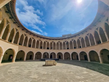
Gran Canaria
Gran Canaria gets called the "mini continent" and for once the tourism marketing isn't exaggerating. This nearly circular island, about 50 kilometers across, manages to contain sand dunes that look straight out of the Sahara, deep green pine forests, dramatic canyon systems with emerald reservoirs, arid mountain valleys, and a capital city (Las Palmas) that's one of the most lively in the Atlantic. The variety is almost absurd for a landmass this size.

Roque Nublo is the island's landmark: an 80-meter basalt monolith standing on a ridge in the center of the island. The hike to the base takes about 30 minutes from the parking area and is easy enough for anyone in reasonable shape. But the real reward is the view. On a clear day you can see Tenerife with Teide poking above the clouds across the sea, and the 360-degree panorama over Gran Canaria's interior is one of the best viewpoints in the archipelago.


The interior highlands are crisscrossed with roads that wind through pine forests and along canyon rims, and the driving alone is half the experience. The Presa de Parralillo, a reservoir tucked between sheer canyon walls, is one of those spots that makes you pull over and just stare. The water is an impossible shade of green against the red and brown rock, and the whole thing looks more like a scene from a nature documentary about South America than a Spanish island.

The south coast has the resort strips (Maspalomas, Playa del Inglés) and the famous Maspalomas Dunes, a field of golden sand dunes that stretches along the coast like a miniature Sahara. They're genuinely impressive and walking through them at sunset, with the Atlantic on one side and the dune ridges catching the light on the other, is worth the crowds at the beach end.

Las Palmas de Gran Canaria is the biggest city in the Canaries and one of the most cosmopolitan places in the Atlantic. The old quarter of Vegueta has colonial architecture, a cathedral, a museum dedicated to Columbus (he stopped here on the way to the Americas), and the kind of narrow streets and small plazas that make you want to wander with no plan. The city's beach, Playa de las Canteras, is a long golden-sand city beach that's somehow both urban and beautiful, and the surf break at the south end (La Cícer) has a serious local surf community.
La Palma
La Palma is the island that reminds you the Canaries are volcanic in the most literal, most recently-happened-while-people-were-watching sense of the word. On September 19, 2021, the Cumbre Vieja volcanic ridge erupted. Lava flowed downhill for 85 days, burying entire neighborhoods, destroying over 1,600 buildings, and reshaping the coastline where it poured into the sea. I landed on La Palma roughly 12 hours after the eruption started. My hotel, booked months in advance, canceled while I was still in the air because it was in the lava flow zone. Welcome to the island.

It was a mixed experience, to put it mildly. One night, ash started raining down on the house I was staying in. And I don't mean soft, powdery ash drifting down like snow. This was grit, somewhere between the size of semolina and lentils, clattering against the roof and windows like someone was pouring gravel from the sky. Spooky doesn't begin to cover it. Getting it in your eyes was genuinely painful. The next morning, my rental car was buried under a layer of volcanic ash, and I decided it was time to relocate somewhere a bit further from the volcano that was very actively doing volcano things. I packed up and fled to the other side of the island, which felt like the sensible move at the time and still does.

The eruption ended in December 2021, and the island is very much open and welcoming visitors. But the scars are visible. You can drive through areas where the lava flow crossed roads, see the edge of the flow field where houses on one side survived and houses on the other side are gone, and visit viewpoints overlooking the new volcanic cone. It's sobering and fascinating in equal measure.
But La Palma was extraordinary long before the eruption. The island is sometimes called "La Isla Bonita" (yes, like the Madonna song) and it earns the name. This is the steepest island in the world relative to its size, rising from sea level to 2,426 meters in just a few kilometers. The Caldera de Taburiente is a massive erosion crater (not actually a volcanic caldera, despite the name) in the center of the island: a yawning green abyss surrounded by ridgelines that rise above the clouds. Standing on the rim at the Roque de los Muchachos viewpoint, looking down into the caldera with clouds filling the valley below, is one of the most vertigo-inducing views I've ever experienced.

The Roque de los Muchachos is also home to one of the world's most important astronomical observatories. The combination of altitude, clean air, low light pollution, and a temperature inversion layer that traps clouds below the summit makes La Palma one of the three best stargazing locations on the planet (alongside Hawaii and Chile). The entire island is a UNESCO Starlight Reserve, and on a clear night the Milky Way is so bright it casts shadows.


The laurel forest on La Palma is the other showstopper. The northeast of the island, especially the area around Los Tilos, is covered in laurisilva, a type of subtropical forest that covered much of southern Europe millions of years ago before the ice ages wiped it out. It survived on the Canary Islands (and Madeira and the Azores) because the islands' mild climate and trade-wind moisture kept the conditions right. Walking into Los Tilos feels like stepping into a different geological era: giant ferns, moss-covered trees dripping with moisture, narrow gorges between cliff walls, and a green so deep it barely looks real.


Santa Cruz de La Palma, the capital, is a small but gorgeous colonial town on the east coast. Colorful facades, wooden balconies, cobblestone streets, and a waterfront with replica ships from the island's maritime history. It's compact enough to walk in an afternoon and charming enough to make you consider what life would be like if you just... stayed.

The west coast of La Palma is wild and sparsely populated, with rough Atlantic waves smashing against black volcanic cliffs. The contrast with the lush east side is stark and beautiful. La Palma rewards effort. The trails are steep, the roads are winding, and nothing here is designed for mass tourism. That's exactly the point.
La Palma is my favorite of the Canary Islands. It's not quite as beautiful as Flores in the Azores, but it comes close, and that's about the highest compliment I can give an island.
The Other Islands
Fuerteventura is the beach island. The second largest in the archipelago but the least populated, Fuerteventura is essentially a giant sandbar with some mountains attached. The beaches here are the best in the Canaries: long, wide, golden or white sand, and often empty because the island is so big and the population so small that the tourists just spread out. The wind is constant (this is one of Europe's top windsurfing and kitesurfing spots), the interior is a beautiful arid emptiness of eroded mountains and goat farms, and the pace of life is slower than slow.
The majorero goat cheese from Fuerteventura is DOP-protected and excellent. The goats outnumber people on parts of the island, which tells you everything about the kind of place this is.
La Gomera is tiny, round, deeply green, and home to one of the most unusual cultural traditions in the world: Silbo Gomero, a whistled language. In a place where steep ravines made shouting across valleys impossible, the inhabitants developed a system of whistled Spanish that can carry for up to five kilometers across the landscape. It's a UNESCO Intangible Cultural Heritage, still taught in schools, and hearing someone whistle a full conversation across a valley is one of those travel moments that just makes you grin.
La Gomera's Garajonay National Park is another UNESCO-listed laurel forest, even larger than La Palma's, and the island has some of the best hiking in the Canaries. The cloud waterfall phenomenon, where trade-wind clouds spill over the central ridge and cascade down the south side like a slow-motion waterfall, is one of the most spectacular weather events you'll ever see.
El Hierro is the smallest, westernmost, and most remote of the main Canary Islands. It was once considered the end of the known world. Today it runs almost entirely on renewable energy (wind and hydro), has a population of about 11,000, some of the best diving in the Atlantic, and zero mass tourism. Getting there requires a ferry or a small plane, and that's exactly the filter that keeps it special. If you want to go somewhere that feels genuinely off the grid while technically never leaving the EU, El Hierro is your place.
When to Go
Here's the thing about the Canary Islands: there is no bad time. The nickname "Islands of Eternal Spring" is not marketing fluff. Temperatures on the coast stay between 18 and 28 degrees all year round, and the sun shows up reliably in every month. That said, there are better and worse times depending on what you wanna do.
March to May is the sweet spot. Warm, sunny, not yet peak season, wildflowers blooming on the hillsides, and the north sides of the islands are at their greenest. The sea is still a bit cool (19 to 20 degrees) but swimmable if you're not a cold-water coward. This is also the best window for hiking because temperatures in the mountains are comfortable and the trails aren't packed.
June to September is summer, but a Canarian summer is not a mainland Spanish summer. Temperatures rarely break 30 degrees on the coast, thanks to the trade winds. It's hot and dry but not brutal. Ironically, summer is slightly less crowded than winter because the northern Europeans who make up the tourist base are at their own beaches at home. August brings the Spanish domestic holiday rush, but it's still more manageable than winter peak.
October to February is when the Canaries earn their reputation as Europe's winter escape. Temperatures on the coast stay around 18 to 22 degrees (while London, Berlin, and Stockholm freeze), and the resorts fill up with people who've had enough of darkness at 4 PM. Prices spike from December to February, and the resort areas on Tenerife and Gran Canaria get busy. The trade-off: the mountains get dramatic clouds, the landscapes are green, and the light is gorgeous.
A word about the calima: occasionally (mostly in summer but possible any time), hot, dusty air from the Sahara blows across the islands, turning the sky orange, dropping visibility, and raising temperatures significantly. A calima usually lasts two to five days. It's not dangerous but it's unpleasant, and if your week happens to coincide with one, you'll spend it sweating indoors with gritty eyes. There's no predicting or avoiding it; it's just the cost of living 100 kilometers from the world's largest desert.
How Long to Stay
One week is good for exploring a single island properly. Tenerife, Gran Canaria, and Lanzarote are the easiest single-island trips because they have the most variety and infrastructure. A week gives you time to see the highlights, do some hiking or driving, and still have beach days.
Two weeks opens up island-hopping. The classic combo is two or three islands, spending three to five days on each. Tenerife + Lanzarote is a popular pairing (volcanic giant + volcanic art project). Gran Canaria + Fuerteventura works if you want mountain variety plus beach. La Palma + La Gomera is the nature-and-hiking combo. The smaller islands pair well together because they're less hectic and reward a slower pace.
Three weeks or more lets you do the archipelago justice. Four or five islands, with time to hike, eat well, and have lazy afternoons. The Canaries are the kind of destination where rushing defeats the purpose, and the best moments tend to happen when you have nowhere specific to be.
Food
Canarian food is peasant food elevated by quality ingredients and volcanic soil, and it revolves around a small number of dishes that you'll eat over and over because they're that good.
Papas arrugadas are the signature dish: small potatoes boiled in heavily salted water until the skin wrinkles and develops a white salt crust, served with mojo sauce. Mojo verde (green, made from cilantro and parsley) and mojo rojo (red, made from peppers and sometimes fiery hot) are served with everything on the islands. These little potatoes with their sauces look like nothing and taste like a revelation. Every restaurant serves them. The quality varies, but even average papas arrugadas are excellent.
Gofio is toasted grain flour (usually wheat or corn) that's been a staple in the Canaries since the pre-Hispanic Guanche civilization. It shows up everywhere: mixed into soups, rolled into balls (gofio escaldado), kneaded with cheese and honey as a dessert, even sprinkled into milk for breakfast. It's one of those ingredients that sounds boring on paper and turns out to be deeply comforting and versatile.
Fish is excellent across the islands. Vieja (parrotfish), cherne (wreckfish), and sama (red seabream) are the local stars, usually served grilled with mojo and papas arrugadas. Fish in the Canaries is remarkably fresh because the fishing fleet is active and the Atlantic waters around the islands are rich.
Queso asado (grilled cheese) is a thing here and it's beautiful. Sliced local cheese, grilled until the outside caramelizes, served with mojo or palm honey (miel de palma, especially on La Gomera). The goat cheeses from Fuerteventura and Gran Canaria are particularly good.
Bienmesabe is a dessert made from ground almonds, honey, eggs, and lemon, and it tastes like what almond paste wishes it could be. Heavy, sweet, and extremely Canarian.
The local wines are a genuine surprise. Lanzarote's Malvasía from La Geria is excellent. Tenerife has several small wine regions producing reds and whites from volcanic soil. The wines are hard to find outside the islands, which makes drinking them locally feel like a secret.
Ron miel (honey rum) is the after-dinner drink of the Canaries: a sweet, sticky, dangerously easy-to-drink combination of rum and honey that tastes like dessert in a glass. Every restaurant will offer it, and saying no requires more willpower than most people have after a good meal.
Getting Around
A rental car is essential on every island except maybe Las Palmas city. The islands are small but the terrain is steep and winding, and the best spots (viewpoints, secluded beaches, mountain villages, national parks) are only accessible by car. Driving on the islands is straightforward: the roads are well-maintained, traffic outside the cities is light, and the mountain roads, while narrow and curvy, are manageable if you're comfortable with switchbacks.
Inter-island travel comes in two flavors: ferries and flights. Fred Olsen and Naviera Armas run ferries between most island pairs, ranging from 30 minutes (Lanzarote to Fuerteventura) to several hours (Tenerife to Gran Canaria). Binter and Canaryfly operate short inter-island flights that take 25 to 45 minutes and are often surprisingly affordable if booked early.
Buses (called guaguas locally, not autobuses) exist on all islands and cover the main routes, but frequency drops fast outside the cities and resort areas. On Tenerife and Gran Canaria, the bus networks are decent enough for budget travelers willing to plan around timetables. On the smaller islands, you're waiting an hour or more between buses, and some mountain routes only run a couple of times a day. A car gives you freedom that buses simply can't.
Within cities, Las Palmas and Santa Cruz de Tenerife have decent local bus systems and the Tenerife Tram connects Santa Cruz to La Laguna. Taxis are metered and reasonable. Walking works in every old town.
An important quirk: Tenerife has two airports. Tenerife South (TFS) is the tourist airport with most international flights. Tenerife North (TFN) handles inter-island flights and some domestic routes. They're about an hour apart by car. Make sure you know which one your flight uses.
Costs
The Canary Islands benefit from a special tax zone (the ZEC/REF system) which means lower VAT than mainland Spain. This translates to cheaper fuel, cheaper tobacco (if that's your thing), and generally slightly lower prices in shops. Accommodation and restaurants follow the usual supply-and-demand pattern: resorts in peak season are pricey, rural areas and shoulder seasons are bargains.
The prices shown here are meant as a rough guide and can vary over time. While I update exchange rates regularly, local prices are typically refreshed only when I revisit the destination.
The Canaries are genuinely good value for Western Europe. Eating out is noticeably cheaper than mainland Spain in many places, and the lack of heating bills in the eternal spring climate seems to keep general costs down. The biggest expenses are inter-island travel (ferries and flights add up if you're hopping) and accommodation in resort areas during peak winter season.
What to Skip
The big south-coast resort strips on Tenerife and Gran Canaria. Playa de las Américas, Los Cristianos, Playa del Inglés. These are functional holiday zones built for package tourists who want a pool, a buffet, and a sunbed. They work for that purpose, but they have zero personality and could be anywhere in the world. If your trip to the Canary Islands doesn't leave the resort strip, you haven't actually visited the Canary Islands.
Tourist trap restaurants near the resorts. The ones with photos of every dish on a laminated menu outside, staffed by people pulling you in from the sidewalk. Walk 10 minutes in any direction and you'll find a guachinche (informal family restaurant) or a local bar serving better food at half the price.
Trying to see every island in one trip. Each island needs at least three to five days to do justice. Trying to hit four or five in a week means you'll spend most of your time in transit (ferry terminals, airports, car rental counters) and see nothing properly. Pick two, maybe three, and actually explore them.
Loro Parque on Tenerife if animal captivity in entertainment parks bothers you. It's a popular attraction and markets itself as a conservation center, but it keeps orcas and dolphins in tanks, and opinions on that are increasingly clear in 2026.
The Saharan dust excuse. If a calima hits during your trip, don't waste the day in your hotel. The air is hazy and the beach is less appealing, but it's a perfect day for museum visits, wine tasting, or exploring towns. Calimas look dramatic in photos, and the orange sky over the volcanic landscape is actually quite photogenic.
What Not to Skip
Teide National Park. Not just the cable car. Drive through the park, stop at the viewpoints, stay for sunset if you can, and come back for stargazing if conditions allow. This is one of the most visually stunning national parks in Europe and it deserves more than a cable car ride and a photo.
At least one César Manrique site on Lanzarote. The Jameos del Agua, Cueva de los Verdes, Jardín de Cactus, or Mirador del Río. They're all unique, all beautifully integrated with the volcanic landscape, and they explain why Lanzarote looks and feels the way it does. If you only pick one, make it the Cueva de los Verdes.
The interior of whichever island you're on. Every island in the Canaries has a dramatic, under-visited interior that's completely different from the coast. Drive into the mountains. Take a hiking trail. Visit a rural village. This is where the real Canaries live.
Papas arrugadas at a local bar, not a tourist restaurant. The difference between tourist-menu papas and the real thing at a village bar is the difference between reheated leftovers and home cooking. Find a guachinche. Eat what the locals eat. Your taste buds will thank you.
Stargazing. The Canary Islands have some of the best night skies in the Northern Hemisphere, and multiple islands have certified Starlight Reserves. Teide, La Palma's Roque de los Muchachos, and El Hierro are the top spots. Even without a guided tour, just stepping outside on a clear night and looking up will be memorable if you come from a light-polluted city.
Lanzarote's volcanic landscape. Not just Timanfaya (though that's essential). Drive through the lava fields on the secondary roads, visit La Geria for wine, see the green lagoon at El Golfo, explore a lava tube. Lanzarote's volcanic scenery is unlike anything else in Europe and it deserves more than a bus tour.
La Palma's laurel forest. If you make it to La Palma, the hike through Los Tilos is one of the most magical experiences in the Canaries. Walking through a forest that's been growing in the same spot for millions of years, dripping with moisture, covered in ferns and moss, is about as close to time travel as you can get.
Common Mistakes
Only booking the south coast. The most common error. People fly in, take a transfer to a south-coast resort, and never see the island they're on. The resort coasts are the least interesting part of every Canary Island. The mountains, the interiors, the north coasts, the volcanic landscapes, and the small towns are where these islands become special.
Not renting a car. You can get by on buses, but you'll miss most of the good stuff. The Canaries are driving islands. The roads are scenic, the distances are short, and the best viewpoints, trails, and beaches are only accessible by car. Rental cars here are cheap by European standards. There's no good reason not to get one.
Misjudging the terrain. The islands are small on a map, but they're steep. A drive that looks like 30 minutes on paper can take over an hour on a winding mountain road. Don't plan tight itineraries that assume flat, highway-speed driving. Leave buffer time for the curves, the viewpoint stops, and the goat standing in the middle of the road.
Underestimating the ocean. The Canary Islands are in the Atlantic, not the Mediterranean. The currents are strong, the waves can be powerful, and even calm-looking beaches can have undertows. Pay attention to the flag system (red = don't swim, yellow = be careful, green = go), and don't assume that warm weather means gentle water.
Forgetting the time difference. The Canaries are one hour behind mainland Spain. If you're flying in from Madrid or Barcelona, you gain an hour. This sounds trivial until you miss a ferry or show up an hour early for a restaurant reservation. Set your phone to auto-update and double-check everything.
Not packing layers for the mountains. It can be 25 degrees on the coast and 5 degrees at the summit of Teide. The altitude change is extreme and the temperature follows. If you're planning to drive up into the mountains or hike in the national parks, bring a warm layer regardless of how hot it is at sea level.
Assuming all islands are the same. Tenerife is not Lanzarote is not La Palma is not Fuerteventura. Each island has a completely different character, landscape, and atmosphere. Choosing based on "they're all the Canaries" is like choosing between Iceland and Italy because "they're both in Europe." Research which island matches what you want from the trip.
Skipping the food beyond papas arrugadas. The papas are incredible, yes. But if that's all you eat, you're missing the grilled fish, the goat cheese, the gofio, the bienmesabe, and the local wines. Canarian cuisine is simple but it's built on volcanic soil and Atlantic ingredients, and it's much better than most visitors expect.
Destination Info
Published March 2026.